Pictures
We hold an extensive catalogue of pictures of Kempshott and the surrounding districts for our own research purposes. Most of these have been published elsewhere, in particular the work of Robert Brown in photographing old Basingstoke before it disappeared.
The picture gallery on this website is held in a series of 5 themed files of pictures which either have not been used in one of our research papers or were not shown in full detail within a paper. They are:
Down Grange – House, Farm and Estate
Kempshott Village 1908 – 1938
Kempshott Churches, Shops and Community centres
Views of old Pack Lane, Kempshott Lane, Buckskin Lane and Homesteads Road
People and Events in Kempshott 1908 – 1980
We expect to upload these items shortly.
Maps
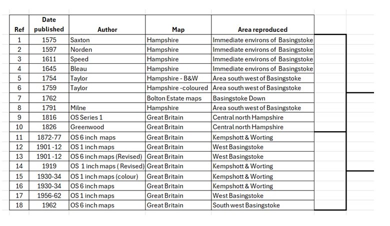
All of the map extracts held on this website to illustrate the development and context for Basingstoke and Kempshott in particular are reproduced from old maps made available by Portsmouth University and the National Library of Scotland map collections, with the exception of the Bolton Estate Maps which are held in Hampshire Record Office.
For cartography enthousiasts we have compiled a short note on map making and how Kempshott has been recorded over the centuries:
A History of Cartography and Kempshott by Barry Dale
An overview of the development of map making from the Romans, through the 16th-17th century with Christopher Saxton, John Norden,John Speed, Willem Janz Blaeu and the advances in the 18th and 19th centuries with Isaac Taylor, Thomas Milne and the Greenwoods to the story of the Ordnance Survey from 1801 to the digital era….here
The maps themselves are held in two files as listed below.
The ‘modern era’ of surveyed mapping starts in 1801 with the first Ordnance Survey maps available to the public. Extracts from these maps take us to the Second Word war. There are many maps in the public domain of different scales, but for our purposes the following extracts illustrate Basingstoke and Kempshott: Maps of 1877, 1904 – 1912, 1934-38
